
Click text for more info
Interface This collection of photographs explores the regeneration of the land that lies alongside interfaces in Belfast. An interface is a Northern Irish term defined as: _‘The boundary between Catholic (Nationalist) and Protestant (Unionist) areas, especially where two highly segregated areas are situated close to each other, are known as interface areas. In many such areas of Belfast the interface is marked by a physical barrier known as a “peaceline”.’_ (http://cain.ulst.ac.uk) Eighty percent of those who were killed in Belfast during the conflict were within 500m of a peaceline. These locations had acted as some of the worst battlegrounds and were continuing to act as a focus for violence in Northern Ireland. The areas closest to the inversely named ‘peacelines’ are still the most dangerous parts of Northern Ireland. The British army arrived in Northern Ireland as a peacekeeping force in 1969. Following numerous attacks on homes in West Belfast, local communities had set up protective barricades. The army quickly replaced these existing barricades with barbed wire structures. Lieutenant General Sir Ian Freeland is often quoted: _‘The peace line will be a very, very temporary affair. We will not have a Berlin Wall or anything like that in this city.’_ Yet Belfast’s peacelines have far outlasted the Berlin Wall and there are now estimated to be up to thirty miles of dividing walls throughout North and West Belfast. None of these walls are planned to come down and the wall was built higher in certain locations this summer. Local residents have been surveyed on the issue and, whilst the vast majority would like them to come down in the future, not a single individual believed that their community was ready to live without a protecting barrier. There are complex borders between communities. The longest peaceline runs three miles long and divides the Shankill Road from the Lower Falls Road, yet other walls are much shorter, encircling and splitting communities in a more problematic series of divisions. In other locations interfaces are invisible: an underground wall in a cemetery dividing the dead; the Westlink motorway; two bus stops at the same location for different communities. Walking along these dividing lines I became interested in the way that land was being used on either side of the interfaces. In some areas, particularly in North Belfast, the division is extreme: facing back gardens are cut in two, a soaring corrugated metal wall slicing rows of terraced house apart. In other areas the presence of the wall has led to entire housing estates emptying, either through individual choice or government policy. This leaves behind a void beside the interface, and the wastelands are left as buffer zones, a further layer of protection or division between communities. Those who remain in these areas are often less socially mobile- the elderly, or the benefit dependent. Residents of interface areas are twice as likely to be unemployed, twice as likely to be on low incomes, and six times less likely to have A-level education than the rest of Northern Ireland. In terms of conflict transformation it is integral to address these areas and enforce change at a grassroots level - nothing will change if those who have been most affected are ignored. The Belfast Regeneration Office is in charge of an extensive renewal and development project throughout the city, particularly in the most deprived areas of North and West Belfast where the streets bear the burden of recent history and the violence continues. The need for new employment opportunities in these areas is key. Belfast was one of the world’s great industrial cities; at one time there were over fifty functioning mills, as well as the famous Harland and Wolff shipyards. Since the sixties, a lack of employment opportunities has been an important issue, the conflict adding an extra layer of complexity to the problems of de-industrialisation. The idea of economic regeneration was written into the Good Friday Agreement (1998): _‘Pending the devolution of powers to a new Northern Ireland Assembly, the British Government will pursue broad policies for sustained economic growth and stability in Northern Ireland and for promoting social inclusion…’._ The government has encouraged engineering companies to set up in Belfast with financial incentives, and new industries such as call centres have also proved successful. The Belfast Regeneration Office has purposefully placed many of these factories and companies at interface areas. This creates jobs within the most deprived areas but also has a number of more complex effects. The wastelands alongside the walls have already acted as a buffer zone, but redeveloping these sites into business parks neutralizes them further still. In many ways these sites act as security installations creating yet another barrier between nationalist/republican and unionist/loyalist communities: The sites themselves are attractive to businesses because of their location relatively close to the city centre. Invest Northern Ireland also rents the spaces at a reduced rate to further encourage tenants. This rezoning from residential to industrial is considered by some to be problematic. Due to a rising population within Republican areas there is high demand for social housing, some argue that this land could be better used for residential regeneration. The business parks could be placed along arterial routes further out of town, as in most cities. Furthermore a high proportion of the residential regeneration that is happening is not for social housing. Former mills are being converted into warehouse apartments and there are fears of gentrification as young professionals move into flats that are deemed too expensive for the local community. There also exists a clear need for mixed housing, whereby members of both the nationalist/republican and unionist/loyalist communities could live side by side, thereby beginning a process of mutual understanding and mixed community involvement within the most conflict affected areas of Belfast. This project consider how planners are manipulating the spaces around interface areas, trying to make sites that are historically territorial into neutral spaces. I am interested in how these newly created landscapes function: as a pretence of normality; as neutral spaces that become devoid of meaning for anyone; or as a complex resolution to the continuing issue of contested space in Belfast. Blanks spaces created by the conflict are being in-filled, a new burgeoning economy is being used as a buffer to drive post-conflict Belfast forwards. Yet these new spaces could be anywhere, they are placeless visions of a distant utopia far removed from the reality of a city blighted by sectarian divides. Ten years after the peace process in Northern Ireland began, these photographs aim to explore, investigate and illuminate a small part of the complexity of peace. Henrietta Williams, 2008
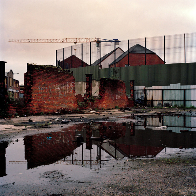
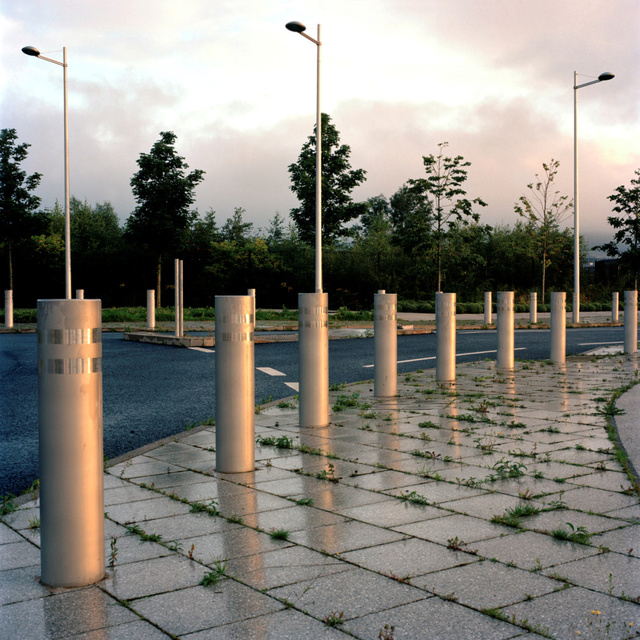
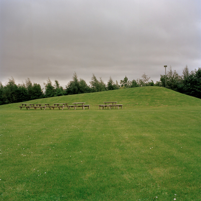
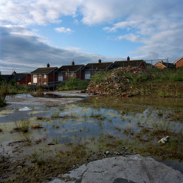
Wasteland bewteen Cupar Way and Third Street, 2008
The site was used as the location of a large bonfire on the Eleventh Night. The structure was made up of wooden palettes and rubber car tyres. Photographs of the the ten men who died during the 1981 Hunger Strikes were pinned to a coffin made out of cardboard that leant against the bonfire. A 'kick-the-pope' band played marching songs as the bonfire was lit.
View from Conway Mill, 2008
New residential developments off the Lower Falls Road viewed from the Conway Mill. The Peaceline is clearly visible behind the houses, on the other side lies a wasteland and the Argyll Business Park.
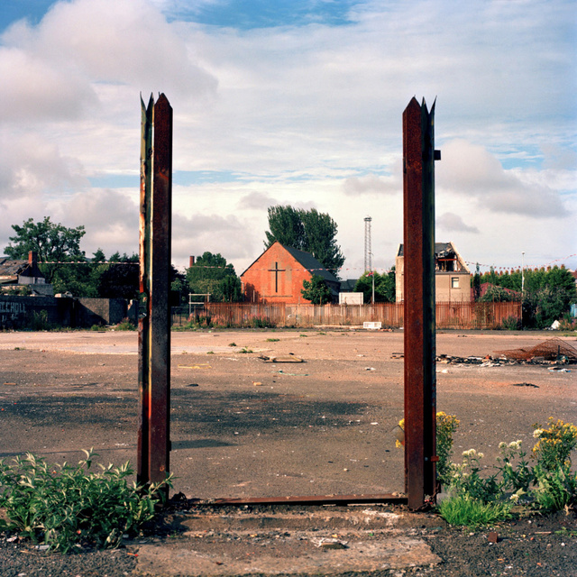
Lanark Way, 2008
Wasteland beside Lanark Way betwen Caledon Street and the Shankill Road. The site was the location of a housing estate that has been cleared. Although the ground has been concreted over, traces remain, like these gate posts.
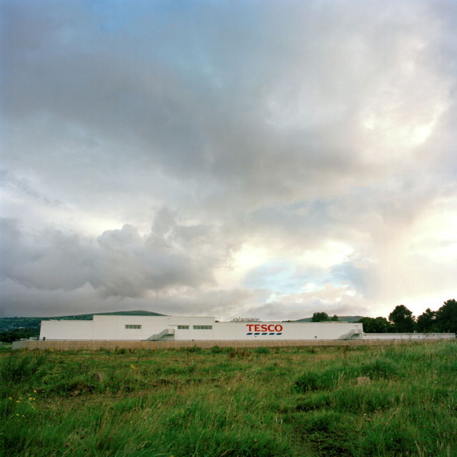
Tesco's, Ballygomartin Road, 2008
The supermarket lies at the edge of a large area of undeveloped land owned by Invest Northern Ireland.
Springfield Road, 2008
Located just off the Springfield Road this route is referred to as 'the road that goes nowhere' by community workers. It was constructed in expectation of the University of Ulster campus being extended to a nearby site. The redevelopment fell through and the road is now gated at one end and blocked with boulders at the other. Once a year the gates are opened and the boulders moved to allow the main body of a contentious Orange Parade to pass through. It provides a route through an interface, between Catholic and Protestant West Belfast.
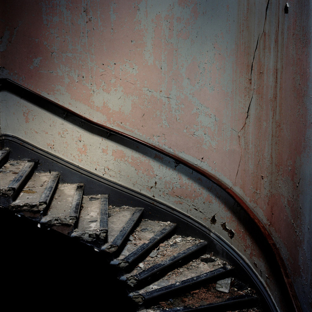
Crumlin Road Courthouse, 2008
Thousands of Loyalist and Republican prisoners were tried here and an underground tunnel connects the site to the Crumlin Gaol across the road. The building was closed in 1998 after over 150 years of solid use. The site was sold for £1 to a Northern Irish property developer and is now in poor repair following a fire in 2004. Planning permission has been granted to turn the site into a luxury hotel but the regeneration project has not yet started.
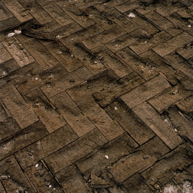
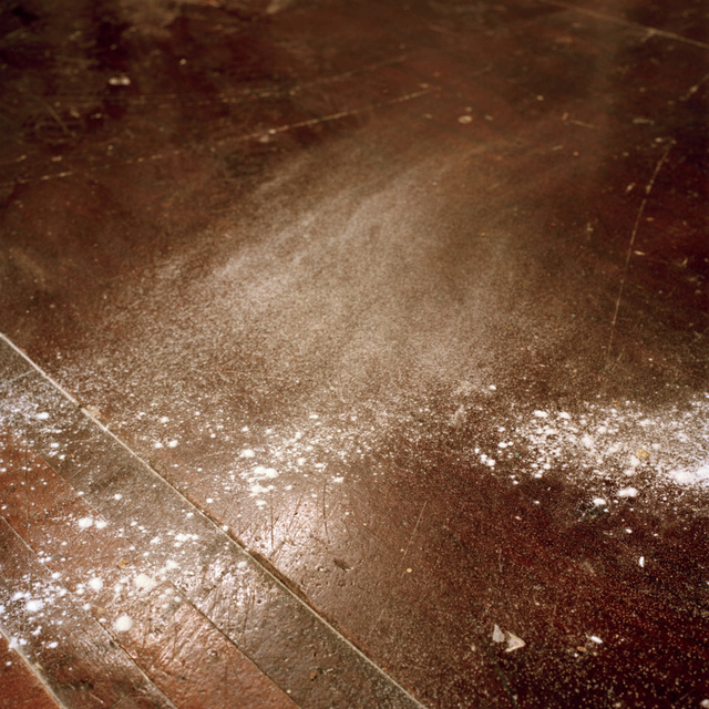
Shankill Road, 2008
Burned parquet flooring at a wasteland beside the Shankill Road, the floor is a remnant from a derelict housing estate. This was a bonfire site on the Eleventh Night and the heat of the nearby bonfire was so great that it scorched the surrounding ground reducing the parquet flooring to charcoal.
Edenderry Loft, Crumlin Road, 2008
New apartments within the Edenderry Loft redevelopment on the Crumlin Road. A two-bedroom apartment is over £100,000 representing a good deal for young professionals wanting to live relatively near to the city centre but still out of the price range of most young local residents. There are no social housing apartments within the complex.
Springvale Business Park, 2008
The Springfield Road area has benefited from a major regeneration program. Historically a site of civil unrest during the conlifct, it suffered from economic and social decline from the 1970s onwards. The area is a direct interface between Catholic and Protestant West Belfast.
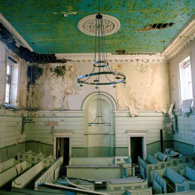
Crumlin Road Courthouse, 2008
Main courtroom where thousands of Loyalist and Republican prisoners were tried during the so-called 'Troubles'.
Andrews Flour Mill, Percy Street, 2008
Spilt flour at the Andrews Flour Mill at Percy Street. Percy Street is considered to by some to have been where the 'Troubles' first started. The mill has been located here since 1895 right between the Lower Falls Road and the Shankill Road. The walls of the factory grounds have become an extension of the peaceline. The mill continued to function during the worst periods of the thirty-year conflict and some of the older employees remember hearing gun shots as they went about their work.
Back of Tesco's, Ballygomartin Road, 2008
Abandoned car park off the Ballygomartin Road next to the Tesco's site. The area lies at the edge of a large area of undeveloped land owned by Invest Northern Ireland.
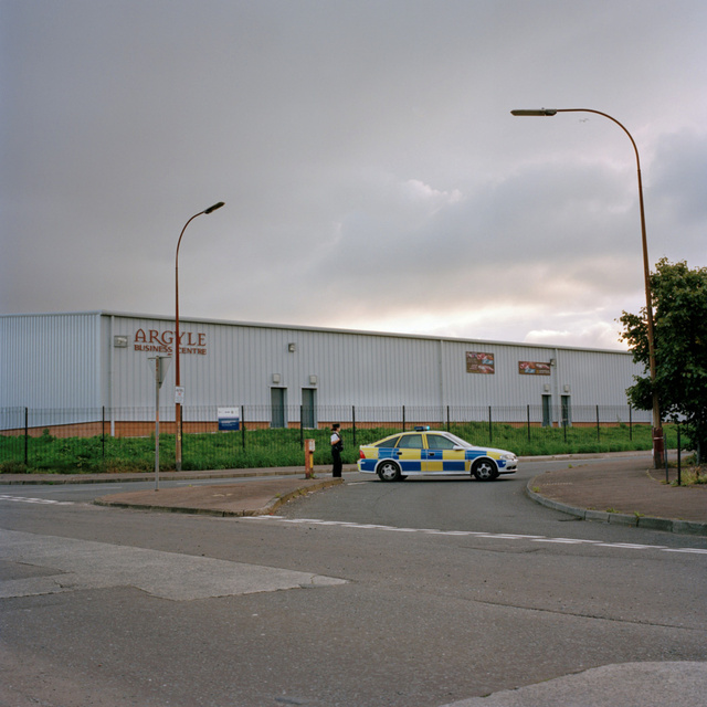
North Howard St, 2008
Police block the entrance to North Howard Street as the army use a scorpion to defuse a suspected bomb. The Argyll Business Centre is in the background. North Howard Street acts as a gateway within the Peaceline.
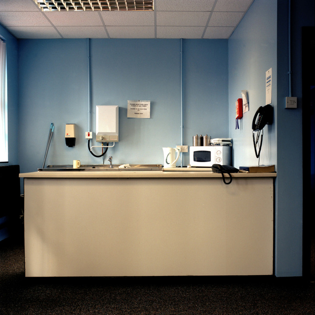
CTI Kitchen, 2008
Kitchen within the offices of the CTI Loyalist Community Group, many of the employees were previously linked to the UDA (Ulster Defence Association, a Loyalist paramilitary group.) Margaret Ritchie of the SDLP (the nationalist Social Democratic and Labour Party) has withdrawn government funding of £1.2million. Ritchie objects to CTI because the UDA have still not officially decommissioned.
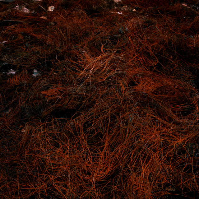
Wasteland bewteen Cupar Way and Third Street, 2008
Piles of wires are left on wastelands throughout Belfast after Eleventh Night Bonfires. Whilst the outside of the bonfires are made of wooden palettes, the insides are filled with old rubber car tyres. The rubber burns away leaving behind the wires in rusting piles.
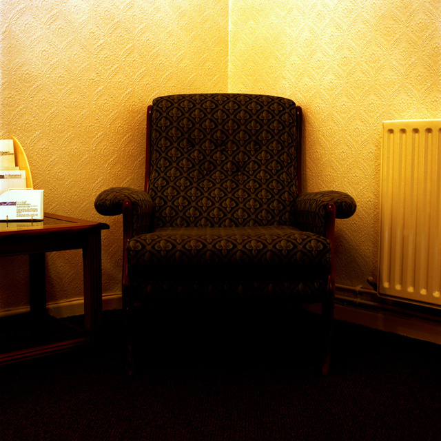
Houston and Williamson Funeral Home, 2008
Chair in the waiting room of funeral director's Houston and Williamson, Crumlin Road. Lying on an interface, the funeral home is non-denominational and is used by Catholics, Protestants, and more recently, Hindus and Muslims.
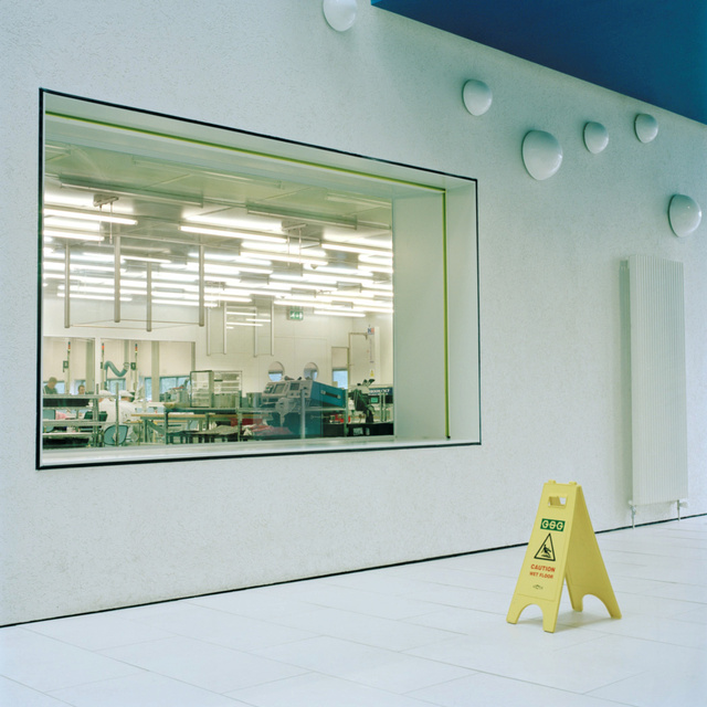
Springvale Business Park, 2008
Window into the factory floor at Andor Technology located in the Springvale Business Park. The company produce high end cameras for use in spaceships and laboratories around the world.
Tesco's, Ballygomartin Road, 2008
View of the Tescos off the Ballygomartin Road. The supermarket lies at the edge of a large area of undeveloped land owned by Invest Northern Ireland.
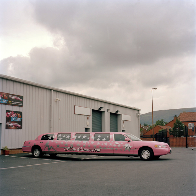
Argyll Business Park, 2008
Hot Limos on the Argyll Business Park, North Howard Street. The company cater mainly to hen parties and also have a pink fire engine.
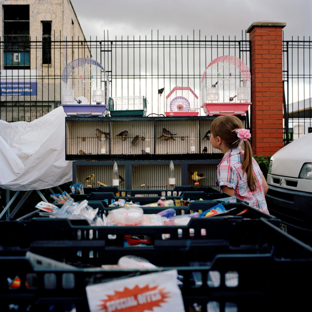
Hillview Enterprise Park, 2008
Caged birds at a car boot sale on the Hillview Enterprise Park, Crumlin Road. The business park is located at an interface between the Crumlin Road and Ardoyne and currently has no tenants since anchor tenant Dunnes Stores moved out. However, the site is the location of a very successful car boot sale on Sunday mornings which is well attended by both communities.
Warehouse at Lanark Way, 2008
Warehouse owned by Stadium Youth and Community Projects. The church group have been running cross community projects between youths from the Falls and Shankill Road for over ten years. They recently sold their church building to purchase this warehouse which is situated at the Lanark Way gate on the peaceline. The group have applied for Peace III funding to develop the building into the City Life Centre, a cross community centre for all ages. The redevelopment has been held up for two years waiting for the funding application to be processed.
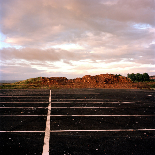
Ballygomartin Road, 2008
Wasteland at the former Mackey's engineering plant off the Ballygomartin Road. Local residents from both communities are working together to block redevelopment plans for residential housing. It is feared this will create another problematic interface.